
Sustainable coastal area planning – relevant examples and application in Whitely Bay
Introduction
When I was doing my research for this term’s housing alternative, I looked out at the River Tyne. I thought of the Whitely Bay I had visited when I first came to Newcastle, with its beautiful beaches, magnificent views, rich flora and fauna, and especially the lovely seals. However, the ecology of the coastal area is being affected by the activities of the people around the beach and by natural erosion. We need sustainable coastal management models to reduce the impact and maintain the development and ecological balance of the coastal area.
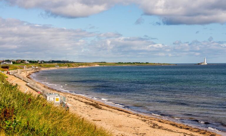
Fig.1 Longsands Beach( Gordon Bell / shutterstock)[1]
Coastal ecosystems are fragile because growing populations, economies, and the demands placed on agriculture and industry to feed, clothe and house the world’s population, as well as global ocean warming and acidification due to climate change[1], are causing severe degradation of the environment near the coast. Before I thought about this issue, countries such as Brazil and Australia had plans and organizations for professional coastal sustainability planning[2]. Brazil’s National Coastal Management Plan refers to the need to assess and monitor coastal ecosystems at a local scale. We need to use the help of GIS systems to understand the coastal environment.
Relevant examples
There is a city called Cide, a coastal city in Turkey near the Black Sea. This city has an excellent coastal sustainability plan[3]. A scholar named Mehmet Cetin has analyzed the success of Cide using GIS methods. The main criteria taken into account in the assessment are the following: balance of protection and development, general plan decisions, accommodation capacity, coastal user density, diversity and capacity of social space, and protected areas[3].
Coastal slope
When he analyses this, the first and most important thing he examines is the impact of slopes on coastal ecosystems. He says, “Where the area’s topography was noted, significant differences in the slope of the structure were analyzed. ‘s area, natural and sociocultural factors that affect life were described.[3]” The cause of this phenomenon is the effect of slope on tidal flushing and light exposure[4]. At the same time, the physical barriers created by the slope also affect the time that species are exposed to the air and the environment that plants and animals can inhabit. Algae, for example, are challenging to grow in areas of solid currents[4].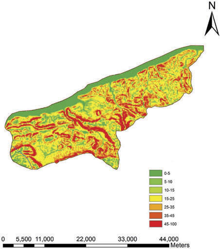
Fig.2 Cide’s digital terrain model[2]
Seasonal changes
The impact of seasonal changes on the artificial environment along the coast is also mentioned in his research. Seasonal visits affect the population of seaside villages and urban centers. In the summer, people from the surrounding provinces visit the Cide seaside because of the sun and the temperature. This behavior leads to a seasonal drop in the town’s population of 8.95%[3]. The visits of tourists lead to pollution and more noise. Moreover, Amany Ragheb, and Haithem El Sharnouby, in their study of built form in coastal ecology, mention that the spare space of buildings can be used as a replacement for demountable buildings near the sea, which will help the urban coastal ecology after moving some of them out[5].
Coastal soils
Finally, Mehmet Cetin analyzed the soil composition and vigor levels of the Cide coastal ecosystem through GIS techniques, which directly influence the types of plants and their growth conditions suitable for growing in the environment. This is despite almost 70% of the land being wooded[3]. However, the populations in the woods also show a different distribution depending on the soil.
Application in Whitely Bay
We already know the application of GIS through previous research cases, so let us talk about my thoughts on the ecologically sustainable management of the Newcastle coast, using the example of Whitely Bay by the sea in Newcastle.
The ecological structure of Whitely Bay
Whitely Bay has a distinct three-layer ecosystem structure: the beach, the sea cliffs[4], and the sea cliffs above. Each of the three layers performs a different ecological function. A beach is primarily a resting place for algal plants and aquatic animals. The sea cliffs provide a resting place for birds and a substrate for the terrestrial environment. Above these are forested grasslands and artificial environments—for example, the Marden Quarry Park[6] and the town of Whitely Bay.
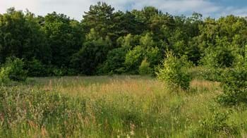
Fig.3 Marden Park
Actions to be done
The first step is to analyze the cliffs’ slope with the help of GIS tools combined with tidal and wind data. It is possible to determine where the sea cliffs of Whitely Bay are likely to change, to prevent disasters in advance, and to plan and protect animal habitats.
Secondly, soil data from Whitely Bay was sampled, and soil analysis was carried out. In this section, the impact of soil composition on the biotope is analyzed first. This process will help us to understand the distribution of the community. Finally, soil vitality classes and how the vitality classes changed over ten years were determined to establish a link between changes in soil capability classes and the built environment. This will enable us to study the damage caused by the built environment to the different protected areas in Whitley Bay.
Conclusion
Newcastle has an abundance of water, a valuable asset that many cities do not have. There is no conflict between developing coastal areas and the concept of sustainability, all we can do is to use them wisely and with a reverent heart.
Reference:
[1] United nations. (2017). Oceans and the Sustainable Development Goals of the 2030 Agenda for Sustainable Development. United Nations, New York.
[2] Juan M. Barragán Muñoz (2001) The Brazilian National Plan for Coastal Management (PNGC), Coastal Management, 29:3, 137-156, DOI: 10.1080/08920750152102017
[3] Mehmet Cetin (2016) Sustainability of urban coastal area management: A case study on Cide, Journal of Sustainable Forestry, 35:7, 527-541, DOI:10.1080/10549811.2016.1228072
[4] Manneville , O. (2022, October 6). Biodiversity of Rocky Shores: Zoning and Ecological Relationships. Environmental Encyclopedia. https://www.encyclopedie-environnement.org/zh/vivant-zh/biodiversity-on-rocky-coasts-zoning-and-ecological-relationships/
[5] Ragheb, A., & Sharnouby, H. E. (2021). Sustainable Urban Development for Costal City Case Study: Bourg El-Bourols City. International Journal of Sustainable Development and Planning, 16(6), 1039–1047. https://doi.org/https://doi.org/10.18280/ijsdp.160605
[6] Marden Quarry Park. (n.d.). North Tyne Side Council. https://my.northtyneside.gov.uk/category/397/marden-quarry-park
Figure:
[1] 15 Best Things to Do in Whitley Bay (Tyne and Wear, England). (n.d.). The Crazy Tourist. https://www.thecrazytourist.com/15-best-things-to-do-in-whitley-bay-tyne-and-wear-england/
[2] Mehmet Cetin (2016) Sustainability of urban coastal area management: A case study on Cide, Journal of Sustainable Forestry, 35:7, 527-541, DOI:10.1080/10549811.2016.1228072